3D Laser Scanning in CT – The Godfrey-Hoffman Office
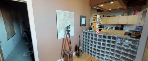
Laser scanning in CT offers an alternative to traditional survey techniques. A high speed laser scanner can capture data of complex surfaces and often inaccessible environments very efficiently. With such scanning, the amount of time spent on site is massively reduced.
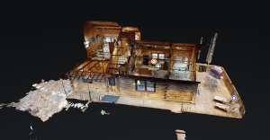
These are some of the many strengths of the point cloud data system. From the many millions of points captured from each setup, detail can be shown to an extent that reveals even texture. Hence, once the site has been scanned, the need for a return visit is rarely necessary due to the completeness and density of the data capture.
Most of our time spent producing a 3D laser will involve processing and drafting the data. Using very CPU intensive programs, we peice together the individual scans to render three dimensional objects in a matter of hours. This complete point cloud can then be traced and computed to produce accurate and very detailed 3D drawings. Once a 3D drawing is produced, 2D drawings can easily be rendered.
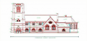
We can turn buildings like this…
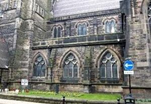
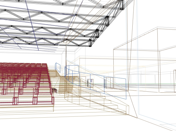
…into this in a matter of hours.
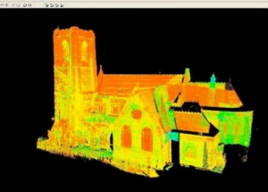
We work with the cloud to produce the drawn 2D elevations you are familiar with.
Civil and Structural Engineering
A 3D laser scan can be used by engineers for any number of projects, and provide a unique array of applications:
- As-built drawings of bridges, roads, and other structures
- Documentation of historical sites
- Site modeling and layout
- Quality control
- Quantity surveys (volume and piles studies)
- Roadway mapping and redesign
- Building information modeling (BIM)
- Establishing a benchmark of pre-existing shape/state in order to detect structural changes
We can also create “fly-by’s” or “camera rolls” of our 3D scans and drawings.
Architectural Navigation
Designed to lend quality control to the overall construction process, architectural navigations, as some would say, “surveying for the next generation”. Cutting edge software allows us to locate any space in real time creating a 3D wireframe model in a .dwg (AutoCAD format) and send via email the same day. This service is designed to keep dimensional quality control over the length of the entire construction process from existing conditions to the construction layout for all the trades as well as built locations. A wire BIM (Building Information Model) will be created and can be turned into a full Revit 3D Model upon request.
These 3D drawings can help bridge the gaps between architectural, engineering design and subcontractor construction, creating a smoother workflow. These often large discrepancies in information between architects, engineers and subcontractors can otherwise increase the amount of time, money and risk needed to complete a project.
Three step process:
- Quality control surveyors conduct an existing conditions study for the building or space before the design plans are finalized. The collected data can then be sent electronically to the architect or engineer so that they may initiate, adjust or add to the proposed or existing design.
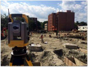
- The architect’s or engineer’s drawing can then be laid out. Our surveyor team is very flexible in regards to how the sub-contractor may want the points laid out. This is in part due to the use of a robotic total station, which can turn itself to the exact location of a design point and track the surveyor’s location in relation to that point in real-time
 .As the project is being constructed, we can make numerous site visits to ensure that what has been installed is in the design location and set at the correct elevation. The topography of a poured deck or slab can be quickly assessed to ensure floor levelness. If the floor is not level, a tolerance of error can be set so we can then mark the areas on the floor that need to be filled.
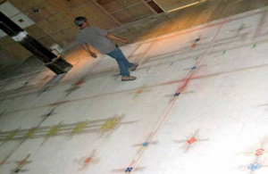
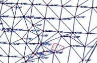
A spray painted layout for all the trades and a TIN file created from topography, set to 1/4″ tolerance.
3. The final as-built will be created. Throughout the construction process, we will have located foundation, anchor bolts, and piles to ensure adherence to the proposed development. Errors or changes will be shown and recorded for final as-constructed documents. We can make separate as-built drawings for each trade or make one model containing all as-built location. This serves as the start of a building information model (BIM) that we could expand to become a fully virtual 3D model.
Overview
We sincerely believe that 3D laser scanning will play a growing role in the design and development industries. Because of a more graphical and detailed drawing, work-flow will be smoother between engineers, architects, and sub-contractors, saving the project time, money and unneeded risk.
Furthermore, owing to the nature of having a three-dimensional graphic of a project site, unforeseen obstacles will be more apparent, such as power-lines cutting across a curve in the site property line, or a line-of-sight issue for a driveway entrance. This, in turn, makes the project costs less volatile over the long-run.
Another perk of such technology is that the ability to recognize a mistake as soon as it happens is optimized. Architectural navigation is a sure bet for the design-build industry in that the vastly increased amount of data engineers, architects, and other designers will have access to with the point cloud 3D scan empowers them to make more informed decisions about their designs.