GHH Acquires Woman Owned Winterbourne Land Services

Winterbourne Land Services: A pioneering surveying firm for women land surveyors

GHH Acquired Winterbourne Land Services, a cutting edge woman owned firm, on November 15th, 2021

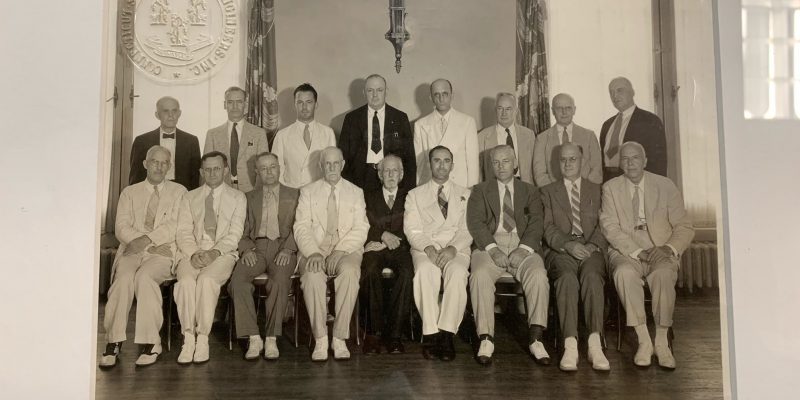
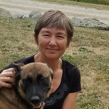
The Woman Behind Winterbourne Land Services 

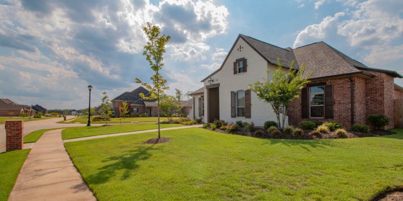
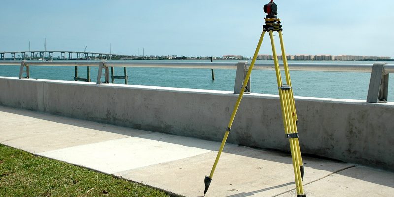
Winterbourne Land Services is a Connecticut historic Land Surveying and Civil Engineering company, established in 1993 by Rosalind C. Page. The firm was one of the first woman owned land surveying companies in the state. Rosalind was one of the few professionally licensed female land surveyors at the time. The Winterbourne team has worked on an abundance of private, commercial, and municipal projects of all shapes and sizes. The firm has performed work within New Haven, Middlesex, and Hartford counties.

Avon Village Center Opening 🎉

Avon Village Center welcomes you! GHH’s newest development with the Carpionato Group

GHH helped develop the newest retail development in Avon, the Avon Village Center with its partner, Carpionato Group, furthering its stake in the commercial development industry, on September 1st, 2021

Developing the Center 

Avon Village Center Ribbon Cutting Ceremony
Ribbon Cutting Ceremony

Godfrey Hoffman Hodge and the Carpionato Group have been working hard on creating the newest commercial development in Avon, CT, Avon Village Center. This modern commercial and residential hybrid development is sure to stay with opportunities abound for locals.

The first retailer to open in the center was the Whole Foods Market, guaranteed to draw large crowds. GHH is proud to announce that we were a part of the ribbon cutting ceremony for the Whole Foods,  formally announcing the opening of the center.

To learn more about the complex’s beginning stages, check out these articles: https://patch.com/connecticut/avon/avon-village-center-phase-1-complete

https://www.avonct.gov/planning-community-development/pages/avon-village-center-project

https://www.carpionatogroup.com/property/486/avon-village-center-avon

Continue reading “Avon Village Center Opening 🎉”

Clarence Blair Associates circa early 1900s

GHH Acquires Clarence Blair Associates 🎊

Clarence Blair Associates, Inc. (CBA) Acquired by Godfrey Hoffman Hodge, LLC. (GHH)

Learn about the historic acquisition of Clarence Blair Associates, one of Connecticut’s oldest surveying & engineering companies.

Godfrey Hoffman Hodge, LLC. (GHH) Is pleased to announce our acquisition of Clarence Blair Associates, Inc. (CBA), as of March 2021. The firm’s extensive historical records will greatly bolster GHH’s own archives relating to New Haven County and beyond.

Clarence Blair Associates History 

Clarence Blair Associates was founded in 1892, earning and diligently maintaining an excellent reputation of high-quality survey and engineering service throughout their long history.  GHH’s current owner, Adam Hoffman, has had a long professional relationship with CBA, dating back early in his survey career, working as an instrument man and survey party chief at CBA in the early 1980s.

Godfrey Hoffman Hodge History

GHH is a third-generation, multi-disciplinary firm established in New Haven County in 1924 under the name Stein and Giordano. In 1968, ownership passed to Bernard E. Godfrey (Also a CBA employee back in the early 1960’s). Godfrey took current owner Adam Hoffman on as business partner and co-owner in 1988, changing our name to Godfrey-Hoffman Associates to reflect the partnership.  In 2010, we acquired the Farmington Valley-based survey firm Hodge Surveying Associates, whose own lengthy history dates back to 1925. In 2020, we adopted our current name to reflect this change. Over the years, GHH has grown to provide a full range of land surveying, civil engineering, planning, design, and permitting services throughout the entire state of Connecticut, operating out of our main office at 26 Broadway, North Haven.

Learn More

Contact Us 

February 23rd is Terminalia! 🎉

Terminalia: Ancient Rome’s February Festival 🏗

Land Surveying Celebrated at the end of the Roman Year (February 23rd)

What is Terminalia?

February 23rd boasts this festival. It is named after the Ancient Roman God of land boundaries, Terminus. Terminus was portrayed as a stone with no arms or legs, symbolizing the boundary marker between plots of land. This portrayal of Terminus was especially important in emphasizing how the boundaries were binding. The name is derived from the Latin word for such a boundary.

Romans believed that a sacrificial festival must occur at the end of each calendar year, February 23rd, in order to remain on good terms with the god. These sacrifices included adorning the physical terminus (boundary marker) with floral garland and offerings of sweets and other meals. It also included physical sacrifices of lambs or pigs.

The terminus was believed to be the peacekeeper between neighbors. It ensured that there would be no arguing over property lines. Neighbors would meet at their local terminus for this celebration annually.  A large feast would then occur! 🍾

Why Celebrate Terminalia?

February 23rd Celebration of Land Surveying
Modern Land Surveying

You may be wondering why a group of land surveyors and civil engineers in the 21st century would want to celebrate an Ancient Roman festival…🤔

The use of terminuses in ancient Rome are the some of the earliest forms of the modern practice of boundary marking with the use of specific objects, markers, or locations. Without the ancient Romans creating a practice of respect between neighbors and foreigners, by placing terminuses between their properties, the art of land surveying may not be where it is today.

Join Us!

While we may not be adorning stone boundary markers or offering sacrifices to a deity, we are celebrating the great history of our profession and the advancements we have made through the centuries. Check out these great resources on Terminalia:

https://www.britannica.com/topic/Terminus

https://pantheon.org/articles/t/terminus.html

https://www.merriam-webster.com/words-at-play/word-history-of-terminate-terminator

https://www.berntseninternational.com/home/blog-builder/happy-terminalia?utm_source=constant%20contact&utm_medium=email&utm_campaign=2021Terminalia

Why Land Surveying is Worth Every Penny

If you are thinking about buying or selling a property, you are likely wondering whether a land survey is necessary. It is undoubtedly tempting to bypass the land survey to save money, yet it presents quite a considerable risk. A professional land survey should preface nearly every single land transaction. Here’s why:

Land Surveys Provide Precise Boundaries Every Property Buyer and Owner Should Know

The sad truth is the majority of current property owners do not know the boundaries of their property. Many such property owners rely on faulty anecdotal evidence for property boundaries. Land surveys might add another step into your project planning, but they are worth the money and time.
Some property owners base their assumptions on information passed on from parents, prior property owners and/or real estate agents. However, there is no guarantee this information is accurate. You need a professional land survey to determine the exact property lines. Every individual bidding on a property and those selling a property should know precisely where its boundaries are. Our professional land surveyors are here to provide this critical information.

A Guideline for Fencing

Plenty of people who buy property intend to add fencing between their property and neighboring land. However, the fencing’s exact positioning is often estimated without concrete evidence of the property’s actual boundaries. It is not enough to simply guesstimate property lines based on where the neighbor stops mowing. You need to know exactly where your property begins and ends to erect barriers appropriately.

Identify the Space for New Construction

If there is confusion about the boundaries of the property, it will be difficult to properly build new structures in exactly the right areas. In some cases, these structures extend beyond the property line. The money you spend for a professional land survey pales in comparison to the cost of moving a building or tearing it down and building it within the actual boundaries of your property.

Understand Exactly What You are Buying

You should know exactly where the property in question extends to, whether a corner is missing, if the neighbor’s fence is on the land and so on. In short, a land survey is a means of protecting this important real estate investment.

Once you know exactly how much land is up for sale, you will be able to enter a truly informed bid that reflects the value of the actual land. Otherwise, you may bid blindly, uncertain of the property’s exact boundaries. It is quite possible misinformation provided about the land’s size will end up costing you thousands or even tens of thousands of dollars. Pay the comparably minor cost of a professional land survey and you will know how far the property in question actually extends. Armed with this valuable information, you can bid on the property in full confidence.

Godfrey Hoffman Hodge LLC is at Your Service

We are proud to provide surveying and engineering services for those located in Connecticut. If you are thinking about buying or selling property, it is imperative that you have it surveyed. Reach out to our main line at 203-239-4217 or our Farmington line at 860-673-0444 to find out more about our land surveying services. If you prefer to contact us online, fill out our contact form and we will be in touch.

Tips For Subdividing Land

Subdividing land requires careful planning well ahead of the time at which the subdivision will occur. However, if you plan accordingly and consult with experts, subdividing land can be successful! Do not attempt a project of this complexity on your own in a DIY (do it yourself) manner. Lean on our team for assistance, follow the tips detailed below, and this process will prove as smooth as possible.

Mind the Steps Necessary for Subdivision

Subdividing a piece of land into smaller pieces for residential and commercial use requires attention to detail. This is not a single step process in the slightest. In fact, there are multiple steps that will take some time to complete. It might take upwards of several months or even several years to complete the subdivision. Be patient, complete all the necessary steps, and your subdivision project will be a success.

Produce a Survey

A survey is required to identify the metes and bounds, meaning the specific boundaries of the property in question. These boundaries set the stage for the proper subdivision of the corner of the property. Land surveys for parcels are priced in accordance with a number of factors including the number of acres, geographic location, and the properties terrain.

A Site Plan is Necessary

The site plan is a detailed document that shows the development plan. The development plan is a description of how one intends to use the land. The amount of detail in the document plan differs from one town to the next. Even the proposed use for the land plays a part in the amount of detail within the site plan. The typical site plans rely on the mapping from the survey, natural resource features, a true north arrow, and elevations. Unnatural developments including paved areas and structures are also considered.

The Property Might Require Rezoning

We urge caution when purchasing a large plot of land that will be used for commercial purposes unless the property is zoned in the proper manner. It is quite challenging to pinpoint available land in residential spaces that are zoned for commercial use. Such plots are typically zoned strictly for residences or rural/agricultural purposes. If the area near the land in question is zoned as non- residential, it might be considered commercial or industrial.

Changing zoning has the potential to prove quite challenging depending on the nuances of the particular area and project. All sorts of different factors have the potential to impact the development time for timely zoning alterations. If the area is in good shape, it might prove challenging to get it rezoned for industrial use. If the land in question is to be used for commercial development yet it is currently zoned differently, you must request a zoning waiver, present a plan to those who staff the zoning board and/or public meetings and provide the board with time for review.

Land Evaluation for Suitability

Development officials typically require in-depth testing along with an extensive evaluation to gauge whether the land will prove suitable for the requested use. Such studies and reviews are a necessary component of the subdivision process. Examples of these tests include site evaluation studies, also called feasibility studies, and environmental impact studies. Feasibility studies consider whether the intended project can actually be implemented on the land.

As long as the soil on the land is acceptable and there is adequate space, your proposed project should pass this evaluation. Environmental impact studies gauge the impact of the proposed project on the surrounding environment in terms of plants, water, air, land, animals, etc.
There is the Potential for Approval With Modifications

After the evaluations are conducted, local boards will gauge whether the proposed project adheres to specific criteria. If the project in question is in full compliance, the office of development will provide approval.
However, if the plan for subdivision is rejected, it is possible to obtain legal remedy through the judicial system. It is much more common for approval to be provided with specific modifications. Implement the suggested changes to achieve compliance and your subdivision of land can move forward in a modified manner.

Godfrey Hoffman Hodge LLC is on Your Side

Our team is here for your surveying and engineering needs in Connecticut, reach out to us today for assistance! You can contact our surveying specialists by dialing 203-239-4217. If you prefer to reach out to us online, fill out our contact form and we will be in touch at our earliest convenience.

Land Surveying Tool

Why Do Survey Prices Vary So Much?

When searching for a property survey, quotes may vary drastically; that’s why we’ve outlined exactly what you should expect out of your next hired surveying project.

A property survey consists of many tasks from land records research to field data collection to office calculations and drafting. In most cases, the time accomplishing those tasks far exceed the time on site. For potential clients seeking to compare prices, the range of prices can be confusing. We hope the following explanation of a surveyor’s obligations helps shed some light on why some surveyors offer a quote that is much higher than others.

Step 1: Researching the History of the Parcel

Each piece of land is unique with its own story to tell. Making sure that the proper historical research has been made is crucial to the beginning of a survey. When researching the history of the parcel of land, it may take anywhere from a few hours to a few days depending on the state department.

Our investigation of the title may lead to more questions that we need to resolve in order to meet our statutory requirements. It is impossible to gauge the level of difficulty and therefore, the amount of time a research job will take, until we are well invested in the project.

Getting It Right The First Time

In some cases, we search far outside the geographical area of our project in order to recover a sizeable sampling of documentation to properly analyze for boundary computations. We want to make sure that our findings and research are 100% accurate before moving onto the next stage. Contact us to get started on your next surveying project here!

Step 2: Office Phase

The office phase of the survey is separated into two parts: drafting and computations.

Drafting

The quality of the drafting depends on the skill of the draftsperson. The finished survey map should be subject to at least two layers of review to ensure adherence to CAD standards and, more importantly, adherence to CT. GEN Statue 20-300b which governs what must be shown on any survey map signed by a licensed surveyor in the state of Connecticut.

Computations

The computation phase of the survey can often be the most time consuming of the entire project. Licensed surveyors first consider the deeds of the subject property and the deeds of the adjoining properties. They also mathematically check any existing survey mapping that was found during research. Consideration and analysis is giving to the survey logic that the previous surveyor used in arriving at their opinion.

In a sense, the surveyor is piecing together a puzzle in which many boundaries are established to ensure they arrive at a logical opinion of the subject property boundaries.

Step 3: Forming a Boundary Line

In the course of collecting data and forming a boundary line opinion, a proficient surveyor should do his or her utmost to ensure that their final opinion of the boundary will withstand challenges, professionally or legally, in the future. That means that a competent surveyor should, to the best of his or her ability, perform all necessary functions to arrive at a defensible opinion. The client must be able to rely on the integrity of the surveyor to do the job properly and to stand by his or her work.

How Do I Choose?

There are many surveyors to choose from. We can only recommend that you choose one who is licensed, insured and most of all, committed to his or her obligation to serve the welfare of the public and who will conscientiously adhere to the standard of care that exist in our profession. 

At Godfrey Hoffman Hodge, LLC, we believe in the value of quality and accuracy. For over 90 years, we have strived to address the unique surveying, engineering, and permitting related needs of our clients by maintaining a highly experienced staff. We realize that using state-of-the-art technology is essential to offering a higher quality product at a reasonable price.

A Message About COVID-19

Dear Valued Customers & Friends,

Godfrey Hoffman Hodge remains open for business.

We are following the CDC guidelines for health & safety and will abide by recommendations as they evolve.

We are, and have been for some time, well-positioned to work from home and can make that transition smoothly should we be called upon to do so. Some of our work may be impacted by town hall closures and meeting cancellations. However, we want to assure clients that we will continue to provide the level of service, communication, and responsiveness that we have built our reputation on.

Surveying by design is a socially distant profession.

5 Reasons to Move Your Business to Connecticut

Connecticut may be coined as the Constitution State, but this powerful & influential state could be home to your next thriving business!

1. First In Healthcare Access

Multiple factors are taken into account when calculating states Healthcare Access. US News reports that seven metrics contribute to this score: child wellness visits, health insurance enrollment, adult wellness visits, adult dental visits, child dental visits, and health care affordability.

Connecticut ranks #1 on this scale, meaning that you and your employees have an easier time when accessing healthcare and staying healthy. Having accessible healthcare will lead to a business with happier and healthier employees.

2. Internship Opportunities

Connecticut happens to be home to some of the most affluent and influential colleges in the nation. No matter where you may move your business to in Connecticut, you will be able to tap into the vast amount of internship resources each of these colleges offer. UCONN, Yale and Quinnipiac are just of a few of these influential universities that Connecticut houses.

3. Travel Hub

This Nutmeg state is positioned between two of the most powerful cities in the nation with superior travel hubs. Creating business relationships is a key part of growth, and traveling may be required by some you or your employees. Finding direct flights will be a breeze when you can easily travel to New York City or Boston and simply be on your way! Not to mention, Connecticut has its very own Bradley Airport which offers hundreds of domestic and international flights.

4. High Per Capita Income

Connecticut currently ranks #6 nationwide in income per household. When your residents have more income, they are more willing to spend it on your business!

5. Availability of commercial properties

LoopNet reports over 500 commercial properties available for purchase. With Connecticut’s tax-advantage sites and GHHLLC’s expertise, moving your business to Connecticut will be easier than ever!

Explore all of our services that we can offer your business, whether you are ready to make a move to a new location, or looking to upgrade your current offices.

View Our Services

Veteran Affairs & Surveying: Assisting Those Who Served

This past Monday, we celebrated and honored the past and present members of our armed forces on Veterans Day. It is an enormous sacrifice to put your life on the line to protect your country and its citizens. 

Godfrey Hoffman Hodge LLC has been working with VA related projects over the years, and it has been an incredibly humbling and beneficial experience to help out these essential groups. 

Connecticut Fisher House

The Connecticut Fisher House is a vital sanctuary for Active Duty Service Members/Veterans and their families. This “home away from home” serves as a temporary living space while these Service Members are undergoing medical treatment. 

West Haven Veterans Hospital

Godfrey Hoffman Hodge LLC has assisted the West Haven Veterans Hospital throughout the years on numerous projects. This branch of the VA Connecticut Healthcare System provides inpatient care to active and veteran service members.

Services for Veteran facilities include:

  • Base mapping for site design
  • Construction stakeouts
  • As-built surveys

As a company, Godfrey Hoffman Hodge LLC is passionate about helping Veterans affairs. If you are looking for surveying & civil engineering services, contact us at info@ghhllc.com